








Dr. Hugh Cutcher
September 8, 2026
Share this post
Summer 2026 brought sharply contrasting solar resource conditions across China as the Western Pacific Subtropical High shifted farther north than normal. The displaced high-pressure system brought more cloud and rainfall to Northeast China while supporting sunnier conditions across Sichuan, Chongqing and Guizhou. Farther south, developing El Niño conditions, reinforced by a positive Indian Ocean Dipole, reduced cloud across eastern Indonesia and Papua New Guinea, although smoke limited irradiance gains in western Indonesia.
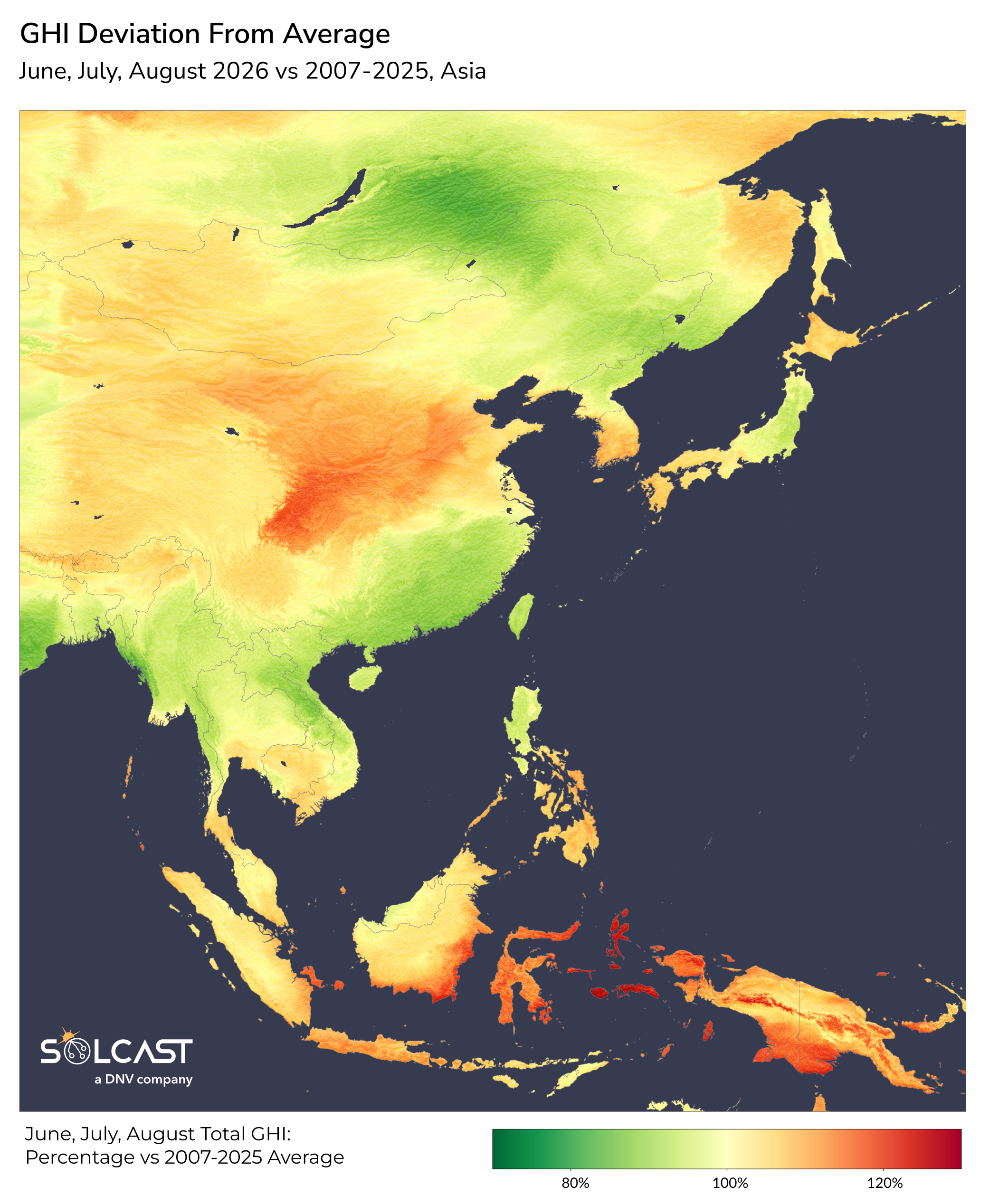
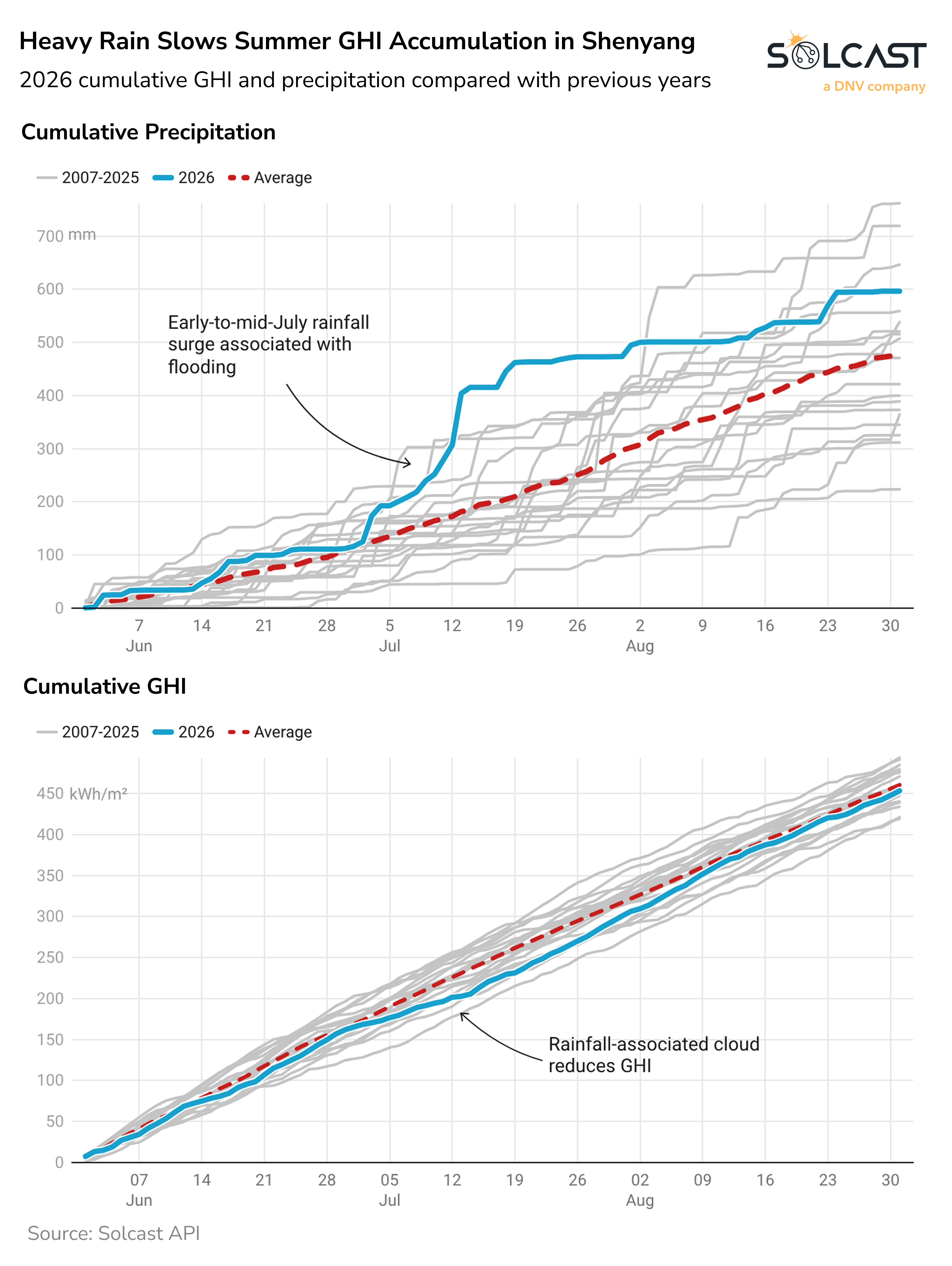
The northward shift of the Western Pacific Subtropical High created opposing irradiance conditions across China. This large, semi-permanent high-pressure system over the western Pacific helps determine the position of China’s summer rain belt and the paths taken by tropical weather systems. In 2026, its northward position carried moist air and persistent rainfall into Northeast China and parts of Siberia, reducing irradiance by as much as 20%. The same shift contributed to flooding in Shenyang in early to mid-July and slowed the accumulation of GHI through the season.
Farther southwest, the high-pressure ridge suppressed cloud over Sichuan, Chongqing and Guizhou, lifting irradiance 20% to 25% above average. The Sichuan Basin was particularly notable. Its enclosed terrain typically supports frequent cloud and fog, giving the basin some of China’s lowest summer GHI based on the 2007-2025 average. Against this low climatological average, relatively small absolute variations produce large percentage anomalies, as is the case with the 25% anomaly this year.
Along southeastern China and across most of Mainland Southeast Asia, irradiance was around 5% to 10% below normal. Easterly winds on the southern side of the displaced high steered tropical systems westward, rather than allowing them to turn north. Tropical Storm Maysak (June 29-July 6) and Typhoon Narra (22-24 August) contributed cloud and rainfall along this corridor.
Farther south, developing El Niño conditions had a clearer influence across Indonesia and neighbouring islands, reducing the rising air that normally supports tropical cloud and rainfall. A positive Indian Ocean Dipole, which commonly reduces rainfall near Indonesia, reinforced this effect. Eastern Indonesia and Papua New Guinea recorded irradiance 20% to 25% above average.
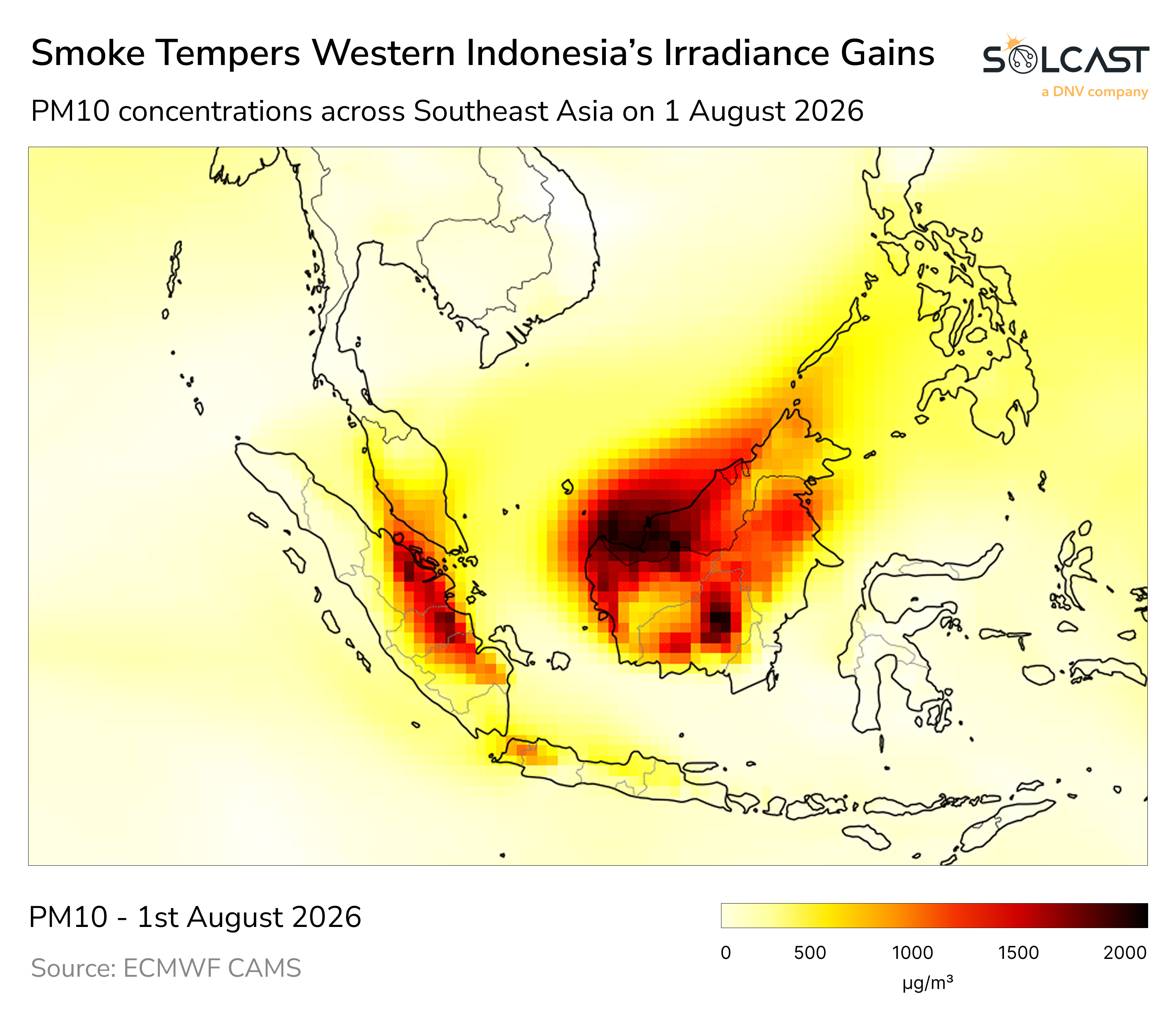
Western Indonesia experienced a smaller increase despite Indonesia recording its driest July since 1991. Fire hotspots in Sumatra and Kalimantan produced smoke during August, scattering and absorbing incoming sunlight and offsetting some of the irradiance increase expected from reduced cloud.
The ECMWF SEAS5 forecast indicates a strong positive irradiance anomaly over Northeast China and Korea in September. This is expected to weaken into a broader, less concentrated area of above-normal irradiance during October and November. The forecast also indicates an early monsoon withdrawal over Mainland Southeast Asia.
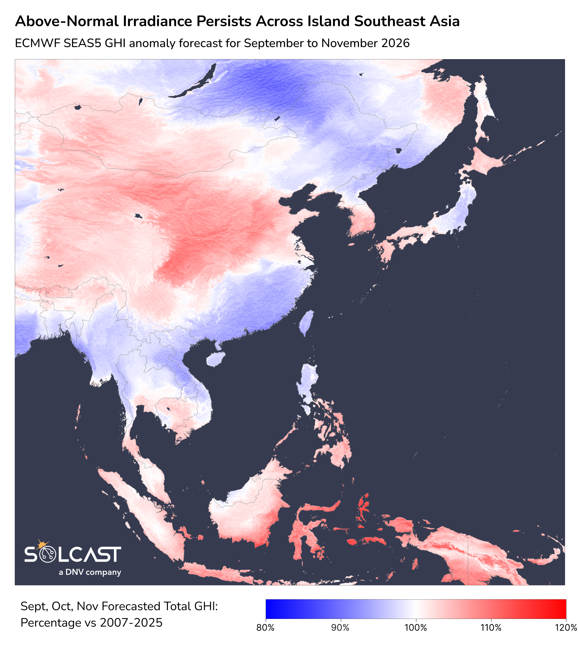
Farther south, above-normal irradiance is forecast to persist across Indonesia and the surrounding islands from September to November. The dry pattern associated with El Niño and the positive Indian Ocean Dipole extends beyond the usual end of the dry season in October, with no clear recovery associated with monsoon onset.
.png)
Track weather conditions, cloud movements, and irradiance-influencing factors that might impact your solar generation. Access bankable actuals and accurate forecasts when you sign up for a Solcast API toolkit. You can reach out to our team for an extended trial.